
With support from the Getty Foundation’s Digital Art History Initiative, Rice University's Farès el-Dahdah, professor of art history, and Alida Metcalf, professor of history, have been working to develop imagineRio, a searchable digital atlas that displays the social and urban evolution of Rio de Janeiro. With this innovative digital platform, users will now be able to easily search and sift through digitized archival photographs, architectural plans, and landscapes that have captured Rio’s dramatic transformation over the years.
“With imagineRio, urban planners can study Rio’s growth over time, local residents can reconstruct changes in their neighborhoods, art historians can speed up once time-consuming research of historic buildings and sites, and literary scholars can map out novels, among many other uses. This is all made possible through innovative geospatial and digital mapping tools and years of archival research, technical experimentation, and cross-continental collaboration.”
imagineRio was made possible through collaborations with the Spatial Studies Lab and Axis Maps and with the financial and technical support of Rice University’s Office of Information Technology, Ken Kennedy Institute, Baker Institute, Fondren Library, the Humanities Research Center, the Department of History, and the Office for Global and Digital Strategy
To read the Getty Foundation’s full coverage of imagineRio and for additional details, visit here.
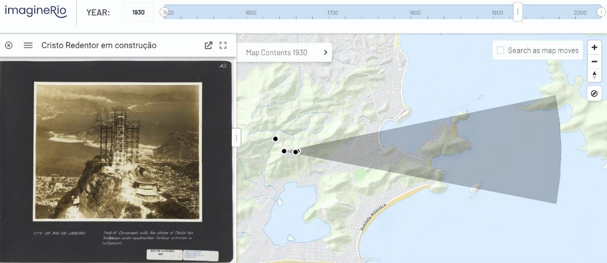
[Image: Geolocated aerial view by S. H. Holland showing Christ The Redeemer under construction. Courtesy imagineRio]